Map: Difference between revisions
No edit summary |
No edit summary |
||
| Line 4: | Line 4: | ||
|title=Local Map | |title=Local Map | ||
|content= | |content= | ||
The | |||
The local map fully unlocks when you find all [[Mapstones]] in a location. | |||
The guide image above shows: | The guide image above shows: | ||
The map modes are: | The map modes are: | ||
| Line 27: | Line 21: | ||
*[[#Angling Map|Angling Map]] | *[[#Angling Map|Angling Map]] | ||
{{PageSection | {{PageSection | ||
| Line 70: | Line 48: | ||
The locations map mode shows points of interest such as: | The locations map mode shows points of interest such as: | ||
[[:Category:Shops|Shops]][[Noticeboard]] | |||
[[Goddess Statues]] | |||
[[Rootways]] | |||
}} | }} | ||
| Line 101: | Line 79: | ||
The world map shows you all the [[:Category:Locations|Locations]] you've discovered, the people you know about that live there and the known points of interest in those locations. | The world map shows you all the [[:Category:Locations|Locations]] you've discovered, the people you know about that live there and the known points of interest in those locations. | ||
}} | }} | ||
Revision as of 22:16, 23 February 2024
{{PageSection
|title=Local Map
|content=
The local map fully unlocks when you find all Mapstones in a location.
The guide image above shows:
The map modes are:
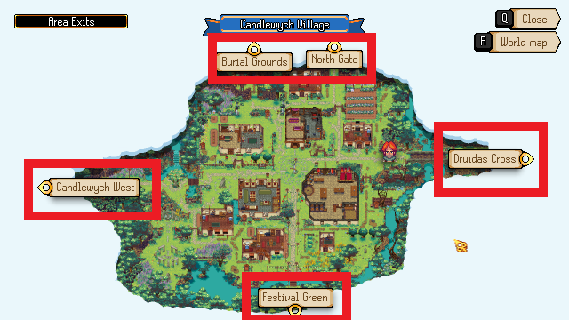
Area Exits
The area exits mode shows other locations connected to this one, walk through these exits to change location.
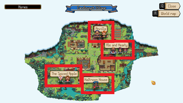
Homes
The homes map mode shows the names of each home in this location, with icons below the name to show who lives there.
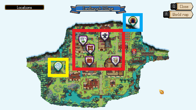
Locations
The locations map mode shows points of interest such as:
ShopsNoticeboard
Goddess Statues
Rootways
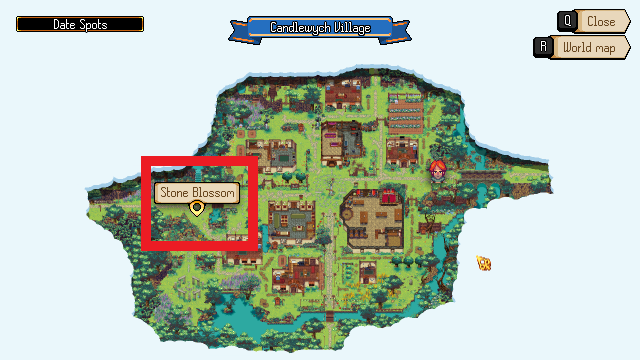
Date Spots
The date spots map mode shows places that can be part of date tasks.
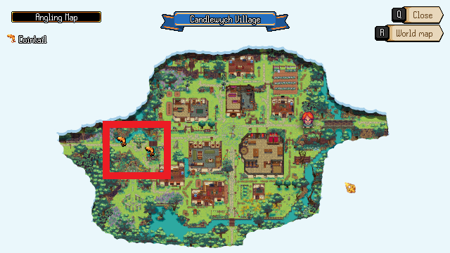
Angling Map
The angling map mode shows the positions of the types of Fish you can catch in this location.
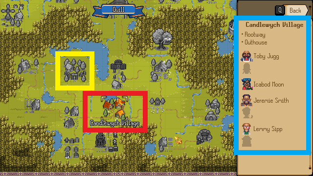
World Map
The world map shows you all the Locations you've discovered, the people you know about that live there and the known points of interest in those locations.
